Speed Post News Network
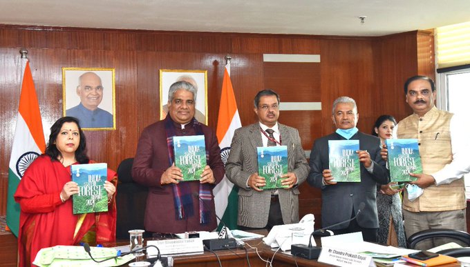
New Delhi : Union Environment, Forest and Climate Change Minister Bhupender Yadav on January 13, 2022, released the ‘India State of Forest Report 2021’ prepared by the Forest Survey of India (FSI) which has been mandated to assess the forest and tree resources of the country.
Sharing the findings, the Minister informed that the total forest and tree cover of the country is 80.9 million hectare which is 24.62 percent of the geographical area of the country. As compared to the assessment of 2019, there is an increase of 2,261 sq km in the total forest and tree cover of the country, according to a PIB release.
Yadav expressed happiness over the fact that the present assessment reveals that 17 states/UT’s have above 33 percent of the geographical area under forest cover and stated that the focus of the government under the leadership of Prime Minister Narendra Modi is not just to conserve the forests quantitatively but to enrich it qualitatively.
The ISFR-2021 provides information on forest cover, tree cover, mangrove cover, growing stock, carbon stock in India’s forests, forest fire monitoring, forest cover in tiger reserve areas, above ground estimates of biomass using SAR data, and climate change hotspots in Indian forests.
MAJOR FINDINGS:
- The total forest and tree cover of the country is 80.9 million hectare which is 24.62 percent of the geographical area of the country. As compared to the assessment of 2019, there is an increase of 2,261 sq km in the total forest and tree cover of the country. Out of this, the increase in the forest cover has been observed as 1,540 sq km and that in tree cover is 721 sq km.
- Increase in forest cover has been observed in open forest followed by very dense forest. Top three states showing increase in forest cover are Andhra Pradesh (647 sq km) followed by Telangana (632 sq km) and Odisha (537 sq km).
- Area-wise Madhya Pradesh has the largest forest cover in the country followed by Arunachal Pradesh, Chhattisgarh, Odisha, and Maharashtra. In terms of forest cover as percentage of total geographical area, the top five States are Mizoram (84.53%), Arunachal Pradesh (79.33%), Meghalaya (76.00%), Manipur (74.34%), and Nagaland (73.90%).
- 17 states/UT’s have above 33 percent of the geographical area under forest cover. Out of these states and UT’s, five states/UTs namely Lakshadweep, Mizoram, Andaman & Nicobar Islands, Arunachal Pradesh, and Meghalaya have more than 75 percent forest cover while 12 states/UTs namely Manipur, Nagaland, Tripura, Goa, Kerala, Sikkim, Uttarakhand, Chhattisgarh, Dadra & Nagar Haveli and Daman & Diu, Assam, and Odisha, have forest cover between 33 percent to 75 percent.
- Total mangrove cover in the country is 4,992 sq km. An increase of 17 sq Km in mangrove cover has been observed as compared to the previous assessment of 2019. Top three states showing mangrove cover increase are Odisha (8 sq km) followed by Maharashtra (4 sq km) and Karnataka (3 sq km).
- Total carbon stock in country’s forest is estimated to be 7,204 million tonnes and there is an increase of 79.4 million tonnes in the carbon stock of country as compared to the last assessment of 2019. The annual increase in the carbon stock is 39.7 million tonnes.
- METHODOLOGY
In tune with the Government of India’s vision of digital India and the need for integration of digital data sets, FSI has used the vector boundary layers of various administrative units up to districts level as provided by Survey of India along with digital open series topo -sheets, in order to ensure comprehensive compatibility with the geographical areas as reported in Census, 2011.
This information provides inputs for various global level inventories, reports such as GHG Inventory, Growing Stock, Carbon Stock, Forest Reference Level (FRL), and international reporting to UNFCCC targets under CBD Global Forest Resource Assessment (GFRA) for planning and scientific management of forests.
The accuracy level achieved in the current assessment is significantly high. The accuracy of forest cover classification has been assessed 92.99%. The accuracy of classification between forest and non-forest classes has been assessed 95.79% against internationally accepted accuracy of classification of more than 85%.
In the present ISFR 2021, FSI has included a new chapter related to the assessment of forest cover in the Tiger Reserves, Corridors and Lion conservation area of India. In this context, the decadal assessment of change in forest cover within Tiger Reserves, Corridors and Lion conservation area helps in assessing the impact of conservation measures and management interventions that have been implemented over the years.

A new initiative of FSI has also been documented in the form of a chapter, where the ‘Above Ground Biomass’ has been estimated. FSI, in collaboration with Space Application Centre (SAC), ISRO, Ahmedabad, initiated a special study for estimation of Above Ground Biomass (AGB) at pan-India level, using L- band of Synthetic Aperture Radar (SAR) data. The results for the States of Assam and Odisha (as well as AGB maps), were presented earlier in ISFR 2019. The interim results for AGB estimates (and AGB maps) for the entire country are presented as a new chapter in ISFR 2021. The detailed report will be published after completion of the study.
